

Chuck78
-
Posts
327 -
Joined
-
Last visited
-
Days Won
2
Content Type
Profiles
Forums
Gallery
Store
Events
Posts posted by Chuck78
-
-
I've run out of planning time today, but it looks like we'll take US-58 and then head towards Wytheville, Va http://goo.gl/maps/43qy3 either on the scenic sweepers US-21 north into the city, or the twisty VA-94 that is on the eastern edge of the city. From Wytheville, it looks like US-52 National Scenic Highway west of Wytheville cuts across the side of Walker Mountain and up towards West Virginia, where we could stay on the northwestern side of the mountain ranges by catching VA-61 northeast to Narrows, VA if we don't find any other really amazing routes to the southeast of there (trying to stay a little closer to home since there are a million awesome twisty and scenic roads all over this part of the country).
From 58, we could potentially make directions real simple and just hit the epic scenery and altitudes of the Blue Ridge Parkway southeast of Wytheville, but it eventually turns into Skyline Drive a while after the BRP turns into a really awesome but easy to ride mountain ridge road, and I don't want to pay the Skyline Drive $10 pass fee for a slow tourist road, as I will have plenty of other breathtaking scenery on the more fun-to-ride twisties, sweepers, and mountains.
This is where I ask myself, "Am I insane for trying to ride mosty twisties and big hills and mountains for 5 or so days straight??? Maybe aiming for some curvey but easy relaxing scenic roads may be a good mix?"
As far as the Blue Ridge Parkway, it's the eastern-most mountain range, and looking a little way northwest of there across some more relaxed terrain, there are a half a dozen mountain peaks that run parallel curving more northward as you follow them east, and they basically go nonstop through Jefferson National Forest, George Washington National Forest, AND the Monongahela National Forest!!! Triple-awesome:) It think it seems like a fair goal to try and ride in and out of that area. as we curve more and more NE/N-NE, and then cut back NW through Monongahela towards Ohio/home.
EDIT: If we proceed with this general route, I have 3 options from Mt Rogers/The Mighty Python - one is that route, second is take 16N to the interstate to VA311 to shave an hour of riding time to save for the best roads ahead, and 3 would be go from US58 to the Blue Ridge Parkway to Roanoke and then catch VA-311
If going that route, WV20 from Clarksburg to New Martinsville on the Ohio River may be a good end to the WV portion from Monongahela
I've gathered a lot of other tips I've been reading on roads that sounded very worth riding, and the user reviews on motorcycleroads.us really help out especially when there are a large amount of comments on a route.
Here are a few other tips and options that I haven't researched yet, from my notes:
Co Route 2 to Smoke Hole Rd is one of the state’s greatest roads. Only recently
paved, this “layover road” hugs clear streams wedged between steep rock
walls, then climbs and darts in and out of the rumpled side of North Fork
Mountain. Feeble-looking guardrails separated us from painful drops.
Through holes in the canopy we were treated to wide-angle shots of
tight clusters of peaks blanketed with thick forest. (MUST RIDE!)
*U.S. Route 33, Harrisonburg, Virginia to Seneca Rocks, West Virginia. east/west roads in this area are wild. U.S. 33 is just such an east/west wonder as we climbed frantically up then down North Fork Mountain. r, caught the video and watched some climbers scale the rock faces.
From the National Park Service visitor center we jumped on U.S. 33 West for another intense session of corner carving, this time over West Virginia’s tallest mountains, sometimes called the Allegheny Front or the Eastern Continental Divide. (MUST RIDE!)
WV-150-Highland Scenic Highway over Black Mountain – some camping, a little jog west from the middle of the Monongahela area
"I did not want to leave the overlooks, the sky was clear and views went on and on. To me it was West Virginia at its best." ""Also known as Mountain Scenic Highway. Great elevation changes, big sweeping curves, West Virginia at it's best!"
*WV 66 - Off of WV 66 little County Road 3 climbs up to Snowshoe
Village through some tight switchbacks and sports 180-degree views of
surrounding peaks.
WV-28 - on the eastern side of the Monongahela area, A wonderfully scenic road full of sweepers and twisties. Up and down thru high mountains and deep valleys, with spectacular views thrown in just for good measure
WV-32 - runs through the broad, grassy Canaan Valley and on to Davis, the highest incorporated town in West Virginia. An old coal/lumber town fallen on hard times, then young outdoor enthusiasts and big-city refugees resurrected it and turned it and sister city Thomas into hip base camps for anything from skiing to mountain biking. We set up camp at nearby Blackwater Falls State Park, then rode back to Susan Moore’s Bright Morning Inn. Talented Curtis Heish*man prepares innovative masterpieces every weekend evening. For this evening he had collected five different kinds of wild mushrooms and artfully combined them into an exquisite pasta dish.
VA-311:" The section we did was from Roanoke up to US-60 at Interstate 64 in Greenbriar Co., WV and was a spectacular road that road takes you over the mountains from VA into WV and had some excellent scenery and great pavement. One of the things I really liked about this road compared to WV-16 was that the pavement was immaculate and free of debris. I didn't try pushing the speeds at all (the video is a little boring unfortunately) but of all the roads we were on, I felt like this one had the best potential to be ridden quickly."
US-119: "Rode this from Charleston to Morgantown and really enjoyed it. Plenty of curves and it's close enough that it could easily be part of a long day ride from Ohio. The traffic is mostly light in the best sections and the pavement is mostly clean, so you can make some really good time."
-
WV-16 is highly recommended Ohio into Virginia (excellent mix of all styles of riding - twisties, valleys, roller coasters, sweepers, & mountain climbs to the south), especially the southern part from Tazwell, VA to the Back of the Dragon double or triple mountain crossings leading to Hungry Mother Lake State Park
 I read one guy's trip through WVa, and he said that road was the highlight of the whole trip
  despite some varying pavement conditions, "many sections are not for beginners."
I think we're going to do 8-10 hours riding the first day, taking the 669/78/260/26/ArchersForkRd route through SE OH, and then WV-16 all the way to the New River Gorge - although after Brownsville, I hear the town of Gauley Bridge is a NOTORIOUS speed trap. I mapped a westward jog around it and across the River to view Kanahwa Falls, and then across again to Hawks Nest State Park and southward into the New River Gorge area for camping in the State Parks and rafting the following day.
Departing the New River Gorge area, I believe a few of our National Park Service campsite options are close to WV-41, which winds down through a gorge and intersects with the New River Gorge. This leads us into the town of Beckley, where we will pick up WV-16 again all the way into VA-16 to Hungry Mother State Forest and it's awesome looking double mountain crossings!
I had planned on taking lots of time around here the day after the New River whitewater will have worn us out, but seeing how great US-58 The Mighty Python National Scenic Highway sounds as it goes through two of the highest mountain peaks in the eastern US, with Bear Claw Holler Bikers Rest Stop & motorcycle store and camping off of 58 not too far from Hungry Mother State Park, this is quickly making me pretty definite on not camping at Hungry Mother and continue with one or two more hours of riding that day to camp off of Jeb Stuart Hwy at US-58- http://goo.gl/maps/lQ8bO
This may be the most definite plan, as this area was the end of my concrete plans, with an east or west decision to be made. A somewhat long ride west would take us to the amazingly beautiful Cherohala Skyway and the over-crowded over-policed 35mph Tail of the Dragon, but with the mountains to the east and a leaning towards a focus on West Virginia, those options have lost favor with me.
I added the option to extend the day's ride to 421 The Snake's "33 miles 489 curves 3 mountains 1 valley" by taking a superslab a little west to hit The Snake eastbound and jog north to US-58 after, may be an option to hit if we decide we don't mind some real loooonnnnggg saddle time the day we depart the New River Gorge area, but I think I am planning to camp here a little way into US-58 that night.
-
I came across this group sometime ago and they have some great maps of this area. They ride them all time and have lots of updates. Created by a motorcyclist for motorcyclists.
https://www.facebook.com/BlueRidgeMotorcycleRides
Also, great pictures. Lots of drool shots............Mary
Lots of inspiring photos, but I didn't see any maps. Maybe if I had a facebook account, I could see more links to maps and such?
-
I've been to Wayne several times, but the Hocking Hills area is almost like our backyard playland, 40 minutes the backroad route until we start to get into the fun hills W/SW of Lancaster
To keep time down for more West Virginia riding and time to relax, I think we'll come out of Columbus on 204e to 757s to Somerset and pick up 669 and follow your route to 78, saving the breathtaking (Burr Oak St Prk) views for a few hours later in WVA.
Then catch 260s off of 78e, and probably veer off on 26 sw. Is there any good fun paved road that will take me from midway on 26 directly south to Newport/St Mary's? That would shave off some backtracking distance if we didn't have to ride backwards to Marietta. It's always questionable trying to plan a route on back roads that could be gravel or in terrible condition. Thanks
-
555 has some good spots, but there are many sections that need some work, especially as you get closer to the river.
I definitely recommend 78/26/260 if you have the time. 26 and 260 are two of my favorite roads in SE Ohio and were in good shape the last time I was on them.
When I'm on 260 and get to the intersection of 26, is 26 southwest of there going to be a substantially more fun road than if I were just to continue on with 260? The southern part of 26 there looks to be one of the best roads in the state just. based on looking at maps!
-
When I picked 78 @ Burr Oak State Park as one of the points to drag the map to, google automatically then routed me south on 555 S to 550 E to Marietta/St Mary's. It's an extra hour to go the route I had in mind taking 78 E to 260 to the river, even more to take 260S to 26 SW to Marietta and back east to St Mary's/Newport. I wasn't too impressed with mostly tar and chip portions of 555 I have been on but many rave about the road. Is it worth an extra hour or more to take 78/260 and maybe 26? Scenery and fun roads are a plus. deforested farmland and lack of twisties and great sweepers is not a big goal... Tough to find heavily forested foothills in that part of SE OH
-
If you are going to pick up 78 anywhere west of Ringgold(555),I recommend going north on 555 until you intersect with 669.Take 669 from Deavertown back to 78 at McConnelsville.All of this section of 669 was paved last year...part of it is very twisty,part is a good riverside ride.It will T into 78 at McConnelsville.
Of the three(800,255,536) you mentioned that you might take to the river,800 is in the best condition.All of it south of 255 was paved in the last two years.I believe 255 is closed right now,but it will probably be open when you plan to ride that area.255 is always fun,536 is starting to get rough.
Have fun on your ride.
Cool, thanks for the tips. We actually rode that area December 1st, but skipped 669 east of 555. You're saying to detour north off of 78 on 555, then back too 78 on 669? I thought 78 was one of the better overall roads in that area, and due to it being so long with highlights all over, it seemed like a perfect candidate for a long road trip to keep directions simple. And I really wanted to ride the section around Burr Oak State Park, despite the deforestation, the views were incredible for Ohio terrain.
Whaddya think of 78 to 260 South (and maybe catch OH-26 on a few hour detour) to the river, then backtrack east to Newport/St Mary's to catch WV16? 260 sounds alright, no super technical turns. 26 has been on my must ride list for a little while. 800 isn't too much further if 260 is no good.
-
I have never been there, but read about it in Rider magazine
http://www.ridermagazine.com/latest-news/great-motorcycle-roads-west-virginia-is-for-riders.htm/
THANKS! Great articles!
-
It looks to be 5 hours south to get to the tail of the Dragon, which apparently is now 35mph & double yellow lines the whole way, with lots of speed traps - especially on the Tennessee side. Also probably pretty heavily travelled, all of which make it less appealing, but I see you can link up to the Cherohala Skyway south of the Dragon for a desolate 51 mile mountain ridge ride to mile high elevations with endless sweepers and breathtaking views. This sounds pretty amazing and makes a cautious law abiding ride through the 'Dragon more worth it.
The Blue Ridge Parkway and Skyline Drive I have very fond memories of from a childhood trip 25 years ago, but Skyline drive is a heavily travelled tourist road with lots of slow traffic (I recall doing 5mph many times while driving through clouds), wildlife, and it costs $10 for a week pass to enter the area. This makes it a little less appealing, as a motorcycle blogger on the tail of the dragon website reassured me of. The scenery was pretty amazing though.
The same blogger said that in no way did it compare to the Blue Ridge Parkway south of there for riding. The Blue Ridge Parkway is quite a ways away from The New River Gorge area, but we are doing a 4-5 day trip. Keeping it concentrated in the WVa/Tail of the Dragon area wouldn't be a bad thing though.
A Suzuki GS Resources Forum member gave the advice "I will never ride the Blue Ridge ParkingLot or Tail of the Staties again with it's 318 cops in 11 miles" despite both being on the AMA's list of top 15 best motorcycle roads in America.
-
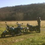
My wife and a few buddies and I are planning on a 4-5 day motorcycle trip in late May, from our homes in central Ohio through the Wayne National Forest area and into West Virginia to go white water rafting at the New River Gorge for one day, and spend the rest of the trip riding fun mountain roads, sightseeing, camping, and hiking. It's a birthday trip for two of us as well
 I think we'll be taking OH-78 across SE Ohio and then possibly ditching it before the WVa border and maybe linking up to one of the 3 or 4 or so really amazing stretches of road that go through the hills and down to the Ohio River (800, 255, and 536 - never have been that way on motorcycle yet!), and then linking up with WV-16 to the New River Gorge area. I'm open to a better route than 78, although I am very fond of it.
I was hoping some of you might have some highly recommended roads and routes beyond that, as well as scenic hikes and excellent primitive camping location recommendations. Any suggestions and advice are greatly appreciated. Looking to one-up the really great twisties and sweepers of SouthEastern Ohio since we will be travelling quite a distance, trying to take in a mix of fun and challenging roads as well as breathtaking scenery.
-
I used to live on klondike the further north you go the more narrow twisty and gravely those roads get. Take it up to route 4 then get on 203 and follow that south some decent turns on that or 257 up that way.
Next time your near 37 and 71 find hogback road I think you'll love that one. There's a parking lot that is off of it park there look for the trail. I think its a horse trail but about 25 yards in it comes to some cliffs that over look the water pretty neat.
Here's a nice long afternoon ride that stays close to Columbus, along Riverside Dr up into Delaware and across several bodies of water, then back south to central Columbus:
http://goo.gl/maps/R0VdE - click on Satellite view for best results
That's the route I was going to try to do today to take a break from my major house renovation projects, but relatives from out of town invited themselves over instead... Hope to do this soon on a warm winter day, gotta love global warming.
cOoTeR, is that parking lot to the cliffs trail that you mentioned the one just to the west of the north end of Hogback Rd? Or is it somewhere along Hogback Rd? I didn't quite see on the maps where there were fun twisty segments of 4, 203, or 257. I mapped it out to cut across Delaware Lake, Alum Creek Lake, hit Hogback Rd, cut over to Hoover Reservoir, and then south down Sunbury Rd/Red Bank Rd and back to Sunbury Rd. This starts and finishes near my house just east of downtown, but you could pick up the route at Riverside Dr and Lane Ave and end it at Sunbury Rd and 5th Ave.
-
Thanks! Glad we rode Saturday, so much rain today. Mountain biking at Chestnut Ridge can wait til another winter day when it's too cold for a motorcycle day trip
-
After some poking around, I think that an amazing trip would be to take this route but stay on 78 all the way to the other segment of Wayne National Forest (Wayne's Ironton Ranger District), and then link up with OH26, which sounds like one of the best best roads Ohio has to offer. Then maybe hit the southern portion of 555, which I think I remember reading was the best section of that road.
-
I will also add that the ridgetop views at many points on 78 especially near Burr Oak State Park were ABSOLUTELY PHENOMENAL! Wow! This portion of the Wayne National Forest area is somewhat lacking in scenery, as SE Ohio in general was almost completely clear cut during the late 1800's to provide wood fuel for the iron mining industry that was booming then. This ride was mostly still clearcut areas that now is used as farmland. Some forested areas, but not like Hocking.
I really really have a soft spot for Hocking, especially after we got our preferred Hocking route tweaked to hit basically every awesome road in the region.
Hocking trip map, 2 pages, map route displays only one page at a time. This ride was REALLY REALLY FUN, I highly recommend this route. The roads leading to Clearcreek were more than a good warmup off of 33. Clearcreek is such an incredibly scenic area that I had no desire to ride fast over the vastly varied pavement conditions, I was in awe over how beautiful the valley, creek, and rock formations were. Not really a high speed road anyways, lots of hikers, fisherman, pedestrians in general. Scenery makes up for it tenfold.
-
Got off to a late start resulting in riding the last of the twisties in the dark, but had a great ride! The first half of the ride was the best, with some big hills and technical turns right off the highway (and gravel in lots of them for the first bit), and 78 was AWESOME, more memorable than 555 for me for sure, although 555 would have been a lot more fun if the sun weren't setting on us while riding on a road that had a lot of turns with a fair amount of gravel in them.
Probably should have either stuck with the original south of I-70 portion of the Dream Ride 2012 route, or skipped the triangle/lower figure-8 portion of our route where we passed 555 on 78, made a right on 377, and then back north on 555. 377 was a repeat of some of the other moderate terrain we did, nothing too special. 555 was a well done tar and chip road , but still some graven here and there. heading back north on 555 about 1 mile before coming back up to 78 again, that part of 555 was really rad and turned back to nice pavement instead of tar and chip, but wasn't worth the extra 18 miles that we road just to hit that. North of 78, 555 was really good, but cars had kicked up too much gravel from the shoulder into the turns, so we couldn't ride it too hard.
Should have just taken 78 East to 555 and made a left, or gone south on 555 for a mile and turned around if you wanted to hit some great hills and backtrack.
669 was just decent on the portions we rode. 668 /93/217/78 was a great route, take that and make a left (North) on 555, or else just keep going on 78, looks like 78 gets better again after a short farm stretch to 377.
78 in general I think would be a fun road to do in it's entirety. If we have any warmer winter days again, I'm going to try and do a Coshocton area ride. Have to help my buddy rebuild his anemic KZ650's carbs first though so he can keep up!
-
Be careful on 555 road has shit all over it. 377 and 78 are fun roads.
As in gravel, branches, & leaves? Or just that it's a real tchnical road?
-
See your 77 GS 750 in your sig, I used to have a 77 550.....oh how I wish I had kept that jewel.

Mine looked just like this......
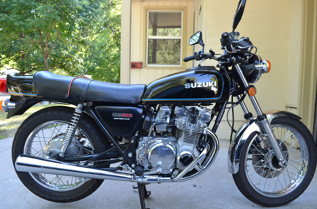
My wife traded her first bike, a big heavy Honda SilverWing, for a ratty old 77 GS550B just like in the picture, but flat black rat look on the fender and tank. Wrenching on that got me into ditching my CB750 and Royal Enfield plans for a GS750, after familiarizing myself quite well with the old Suzuki's!
I just yanked off a GS650 shafty top end (cylinders pistons head cams) from Rice Paddy to swap onto her original 1977 550 with worn piston rings (anyone need a nice 78 550 engine?). Going from a tweaked (jets+DynaIgniton+K&N+glasspacks) 550cc 8.8:1 compression 60-ish hp engine that's real fun to ride, up to 673cc's 9.4:1 compression with same intake/exhaust mods and bigger jets & needles, should boost it to 80+hp easy, will be a blast!
Got a 310mm CBR1100 Blackbird front rotor and Kaw Ninja dual piston Tokico brake caliper to retrofit to the GS single disc for in anticipation of the added power! Need a rear disc wheel like my buddy's 78 GS550 has, have GS1100 rear disc setup that came with an 1100E alloy swingarm that I got for my 750, hope to find a wheel to swap those brakes onto hers someday. Great bikes! the GS750 & GS1000 were the best handling bikes of the 70's, and GS1000 was the fastest bike in the world in that decade!
-
I really wanna do that route on US62 to Millersburg then south on many of the awesome looking roads around there, but the DreamRide2012 google map I found made it too easy for me to pick that route, probably leaving Columbus at noon Saturday. I re-arranged the map, and may skip the northern section near Newark to shave 45 minutes off the ride at the cost of riding on I-70 to 668 to save time and fuel due to empty wallet and time constraints from leaving at noon.
I chopped the E-NE portion of the route in order to hit 377 south off of 78, and take that down to the heart of the Triple Nickel, and then back north to 668, riding on Rt 555 for quite some time.
I COULD REALLY USE SOME SUGGESTIONS ON WHERE THERE ARE GAS STATIONS ON THIS ROUTE!!!
I'm bringing a small can in my saddlebags just in case. One friend that may come along has a 1977 Kaw KZ1000->1132cc gas guzzling grizzly beast, he'll be the tester to see if gas stops are too sparse!
-
Helluva lot cheaper too.
I hear that... Luckily my brother usually buys two season passes for MidOhio, both in his name, so he can bring a guest every time!
-
Mid Ohio
Next June and July (Vintage Grand Prix and AMA Vintage Days)!
Not looking to ride at a track day, a nice stretch of wilderness and long twisty roads is more my style!
-
Awesome, thanks cOoTeR for the routes, I will definitely save those for future rides!
-
Follow the sciota river north from the zoo. Try both sides east and west. Not really twisties but some nice scenery and curves.
I followed Riverside Dr from downtown earlier this year all the way north to the zoo and far beyond, was a nice fun city ride and beyond. I think I rode almost to Delaware on basically the same road, maybe it turned into Klondike Rd or something I think I remember? After Riverside ended at a 4 way stop. Just keep going forward northbound, was a refreshing close ride. Passed just a few cars, and one guy going the other way on a newer sport bike that also looked to be out enjoying the best route inside of the I-270 outerbelt

The wilderness is always where I strive to be, on foot, camping, road biking/camping, mountain biking, motorcycle riding, car sightseeing... But in a pinch when I want a fun little cruise for an hour or so, that was an excellent choice!
-
Found this link to Dream Ride 2012 route!
It's between that and this:
zoom in to NE of Columbus. I always click satellite view so I can see better where the wilderness areas are. Follow 62 N from Columbus into the twisties to Millersburg, then pick my route on any of those awesome twisters south, southeast, southwest (to Coshocton , Zanesville, Salt Fork Lake, and/or Newark) and eventually back to Columbus. I didn't realize there were so many killer roads out that way!
Sunday chance of precipitation just increased a lot during the day, and no longer going to hit 64 degrees, so trying to rearrange the ride for Saturday now. Mountain bike Sunday if it doesn't rain much, not as adversely affected by precipitation as riding twisties on a motorbike!
-
Are you referring to the Apple Valley Mount Vernon area or near Chestnut Ridge?
Route recommendations to New River Gorge WV and beyond
in Daily Ride
Posted · Edited by Chuck78
Day 4 of the trip was a little more difficult to plan, as there isn't a whole lot in the Wytheville to Roanoake areas that is as outstanding as the better choice of roads on the trip, but I think I've pieced together a good stretch. http://goo.gl/maps/VzJlI Continuing from our camping spot on the Mighty Python stretch of US-58 and following the base of 2 of the top 3 tallest mountains in the Eastern US on VA-16 Northbound up to County Rd 622 Nicks Creek Rd to a short 25 minute time saver on the Interstate up to US-52 in Wytheville, which winds around the side of a mountain and then eventually to WV-61, which looks like a winding valley road through farmland in between two mountain ranges. As that ends in Narrows, WV, head south to VA-42 and take that east until it intersects with VA-311, which is another really great and scenic mountain road. Heading to WV-150 Highland Scenic Highway after that, take I64W a short jog west to catch 92n to 39w to WV-150N. This is a breathtakingly scenic and really fun motorcycle motorcycle road worth the extra mileage.
If we wanted to cut to the chase and skip the 3-star roads to shave 1 hour of riding time off to save energy for the 5-star roads, we could cut the entire riding time down to 5.5 hours if after VA-16N, we just stayed on the superslab of I-81E for 90 miles to get to WV-311N. I think I may keep this as an option based on how we're feeling. The Highland Scenic Highway is going to require a lot of rest stops to take in the view, so I hear, and we will still need time to set up camp for the night, which I have yet to determine any locations near WV-150, so that may be more riding time.
This will free up day 5 for going all-out to tour & explore the Monongahela National Forest and the really great Allegheny mountains around there, as well as probably end up at Smoke Hole Rd to camp there and explore. The last day of the trip, we get to tackle the best stretch of US-33 that exists, named by the AMA aas being in their Top 15 best roads in the US, from the eastern end of the mountains east of Smoke Hole Rd all the way over to the other end of the mountains and towards the Ohio River Valley.