Chuck78
-
Posts
327 -
Joined
-
Last visited
-
Days Won
2
Content Type
Profiles
Forums
Gallery
Store
Events
Everything posted by Chuck78
-
78 Nelsonville to 260 was in good enough shape today. A few rough patch areas, but pretty good enough. 565 was great, 537 was great except for the eastbound hillclimb past the lamping homestead picnic area, where the outside lane had started falling down the hillside and had been poorly patceh, and then sagged more. 331 miles today!
-
From Don aka DPep on the GS Resources, he scouted these routes year after year and these were his favorite last revisions before he stopped organizing the rally: ---Quote (Originally by Chuck78)--- don, do you still have that website hosting the old West Virginia Rally routes? can you direct me to the link for that? hope all is well with you, take care, Chuck in Ohio ---End Quote--- Chuck, there was not an actual website. I used the first post in the trip thread as the gateway to the the various links. There were/are three routes, blue, green, and red. The red route is also called the local route. It is just a shortened version of the blue route for those who don't have a full day but want to get in most of the sights that are on the blue. The green route I removed because coal companies have closed off and dug up some of the back roads on it as part of their mining operations. If you can only do one route, I recommend the blue one. http://www.mindspring.com/~dpep/bluert.htm If your time is limited or you just don't want to put in a full day, the local (red) route is the way you want to go. http://www.mindspring.com/~dpep/localrt.htm Here are the turn by turn directions for the blue and red routes. http://www.mindspring.com/~dpep/bluertx.htm http://www.mindspring.com/~dpep/localrtx.htm I don't have the map online but here are the directions for the green route. I would probably not go beyond Green 3 to the Glen Daniel Dairy Queen but set course back toward Beckley from there. There are some good roads beyond that point but a lot of populated area and traffic in between them. And Green 7 is the phase where the roads have been stripped for coal. Green 2 has probably the most technical segment on any of the routes. It is Clear Lake Road (County Road 1) up, over and down a mountain. http://www.mindspring.com/~dpep/greenrtx.htm I hope some of this is of use to you. It is my favorite place to ride.
-
Thanks for the heads up! Others have said it's too rough and they won't ride 536 until it gets repaved, but I guess it';s all relative to the rider's comfort and willingness to dodge bad spots to get to the good curves. I've been out on 541, 60, 93, 83 once, 8th St Rd, Pinecrest, 146, etc many times this summer, all very nice, some brand new pavement. 147 way out east has a killer section nearing the OH River. Fresh pavement.
-
Been there once... almost low sided on the tight 15-20mph s curve slalom zig zag part near Revenge Rd at Christmas Rock (by the penitentiary). I recalled seeing a trail of oil drips that got wider, then coming around the 2nd or 3rd curve along the rock faces, BIG oil patch 20"x40"!!! Big truck trans split it's case open climbing this steep hill in granny gear, dumped 90W gear oil all over the road. Both my tires were sliding like on butter for a few feet, that really sent me in a tizzy. recovered fortunately. Then they for some stupid reason sealcoated the nice pavement on this road last summer and a bud that went down behind me on gravel later in that ride almost dumped his bike in the same place because the sealcoating was fresh and slick...
-
Been there... Really it took myself having a few close calls blazing through turns at insane speeds, and then hitting at deer right out of a turn at 57mph... that all tamed my aggressive riding down a notch/ what it really took was a friend going down while following behind me 3 seasons ago (scraped hard parts, broke traction, spun out across oncoming lane into ditch) and two friends last year going down following me, one gravel, and one very skilled rider following my "too fast into S-curves at Cantwell Cliffs" pace (which I managed well enough due to knowing the road well, but noted my speed/risk was too great). He started to lowside, caught traction again, almost high sided, and got steered through opposing lane and went down into the dirt where he dumped the bike headed down into the woods... All were okay, just all 3 scraped/bruised/shaken up. I had since been on a quest to find the perfect armored jacket (Xelement Executioner!) and still trying to get a good pair of black leathers. Turned it down a notch, and I don't often go more than 5-10mph over unless I have clear sight of any areas that deer could jump out in front of me. Corn fields, dense woods, shrubs along roadside... I always approach them cautiously now even in the straights. Still have to force myself to ease up on the wrist twisting quite, the thrill never gets old even as I near the 40 year old mark.
-
My wife rides, and at a pretty darn rapid pace as at that... I'm more into finding the tightest twisties I can than what she is, but she still really enjoys a good curvey road. I think Kari and her may get along quite well, as Reda has a 77 Suzuki GS550. Not as sport bike oriented as my highly modified 77 GS750 built with late model sport bike parts, but she has no problem handling the best roads we can find in West Virginia. She's taking off as road crew on the American Motordrome Wall of Death motorcycle thrill show for the rest of the riding season, so no chance to hook up this year, but if you get any ladies rides together in the Columbus or SE Ohio area next spring, she will be very eager to meet with other lady riders. She isn't much for forums. I can get you her contact info if you get anything together. By spring we'll have some new wheels laced up for her bike and a fresh 673cc high compression engine and some better suspension, so she will be even more ready for good rural rides.
-
Mary, there are a lot of good back roads to explore south and west of Beckley, but more towards the Gorge area it is closer to Ohio hills and not quite as exhilarating, with the exception of 60 & 16 from Gauley Bridge to 60/Hawks Nest or Gauley Bridge to 16 into Fayetteville, and 61 Deepwater to Kincaid. the 1977 - 1987 Suzuki GS Resources forum has had several rallies in that area, and I will try to dig up some maps that don aka DPep had plotted after many years exploring the area. He had them loaded to a website, so if it is still around, I will try to link that for you. Written directions are probably better than his paper map with highlighted marks on it.
-
Ditto on that, very sorry to hear of your spoiled weekend and tow vehicle problems as well. Maybe you will get lucky and be able to arrange something early to mid September...? I've had the same kind of riding year, hardly any miles whatsoever. 1 GOOD ride and even then 79 had an endless detour & we were almost to our destination @ MidOhio when it would have sent us back east to hit the roads we wanted... & Dave's Ninja started leaking coolant... A few buds are doing a Dolly Sods (West Virginia) weekend October 9th, and I was contemplating going and riding down there. For Davis or nearby towns at medium elevation, avg temps 63hi/39lo. No faring, no heated grips, high altitude passes may even be colder... still pondering. Buddy may take his DR350 with me & we could trailer it there I suppose, ease the 4 hr slab time chill factor Best of luck with a second attempt to you and Ed!
-
I believe there is a bridge out or some other road problem on the good stretch, as I have heard numerous complaints of road closed or detour signs. After the monsoon season, there are three bridges over creeks in that low lying stretch of the best of 56, so something happened in that time.
-

Looking for route suggestions Cbus to...mexican border?
Chuck78 replied to silentcropduster's topic in Daily Ride
Typos above, was going going to suggest the areas around Coshocton & Zanesville as opposed to SE OH, for slightly less technical riding but just as much fun, and no traffic or LEO. Boxed aluminum swingarm on my 77 GS750 helped a lot. Late night typing before falling asleep... not "box aluminum front end." -
Looking for route suggestions Cbus to...mexican border?
Chuck78 replied to silentcropduster's topic in Daily Ride
I was going to suggest out east near Coshocton and Zanesville / southeast Ohio for very fun road but slightly less technical, and almost no traffic and no LEO presence. the routes already suggested above, I think it was by pokey, and one other after, are pretty good. 541 is very nice from 79 all the way to Coshocton. 60 has a decently good section just north of 16, but at Tunnel Hill/541, 60 is very nice through Warsaw and to Killbuck. 83 north of Coshocton is real fun. North & slightly west of there you can catch 79 to Walhonding Rd OH-715 (starts and ends on oh36), then midway into the fun stuff on 715, head north on 206 to the middle of the fun stretch of 62. unfortunately making a route out of 206 involves cutting off half of the good sections of both of those other roads, but it's all in a name of a great route. 16 to 79N to 541E to 83N to 39?W to 60S is a GREAT route with me lots of fun curves and hills, and lots of desolate countryside and wilderness scenery. It takes you through the 20,000 acre Woodbury wildlife area on 541 and 60. if that route was not enough, and you have enough daylight to stay away from Twilight deer strike time, try taking 79 north again (from 60->541) up to 36 and 715 to 206. then 62 West back into Columbus. this is a wonderful and fantastic ride, with almost no traffic, and slightly safer curves than Hocking. Hocking and southeast Ohio offer some very technical stuff, but the other stuff can be just as flowing and fun near Coshocton. -
Looking for route suggestions Cbus to...mexican border?
Chuck78 replied to silentcropduster's topic in Daily Ride
I'm actually always able to out-handle that bike in the twisties against a good friend with a significantly newer ZRX1100... my buddy jack on a newer Ninja 600 is always right on my tail though. It seems to out-handle early ninjas by far though. -
Looking for route suggestions Cbus to...mexican border?
Chuck78 replied to silentcropduster's topic in Daily Ride
Hey, easy there with your insults on my beautiful ol 'Zuk!It actually handles incredibly well in modified form, and in stock form, handled pretty good aside from typical vintage archaic dampening & vintage tires, & handled quite well stock in comparison to the z1's/kz1000's/cb750's of that period. There's a reason Team Yoshimura dropped Kawasaki and started racing Suzuki GS750's & 1000's immediately after they were introduced in '77. The frames handled far better than their competition. My Fox Factory Shox, custom spoked wheels, highly modified front end, and box aluminum front end help a lot as well... -
Looking for route suggestions Cbus to...mexican border?
Chuck78 replied to silentcropduster's topic in Daily Ride
Also a simpler/longer route like 664 from Pickerington area to 56 in South Bloomingville, 56 E to 278 N to Nelsonville, skip across Nelsonville to 78 E - detour on 685 E to 13 N back to 78 E (685 is A BLAST, short & very sweet), then 78 to 60 N to 669 W to 668 N to 204W back into pickerington -
Looking for route suggestions Cbus to...mexican border?
Chuck78 replied to silentcropduster's topic in Daily Ride
664 is a great intermediate road for sure. Linking it with 374 is great, they "X" each other and are joined by a 4-5 mile stretch of 56 between South Bloomingville @ 664/56 & 374's end at 56. That stretch of 56 had road closed signs up after some monsoon season damage, I suspect 1 of 3 bridges washed out. Chapel Ridge Rd parallels it but is NOT a novice road, off camber decreasing radius turns pop up unexpectedly, and it's very narrow. 374 has some more advanced sections than 664. I prefer to hit the twisty hill climbs uphill, so I always do 374S 56w 664n basically is the simplest version of what I love/recommend (my standard route is based on 374 s - big pine Rd e - 664 s - 374 s - 56 w - 664 n - 374 n; I skip the combined portion of 664&374, running up to both intersections but not on the combined 664/374 stretch) -
Another borrowed image of US-33. And another...etc
-
http://www.ridingwv.com/FolderStreetReports/WV06.htm Where I borrow the WV-72 "Warning Narrow Road Sharp Curves Next 15 Miles" sign photo from. Has a good bit on 72. Quite narrow, quite spectacular. More than just 72 info on there, but that's where his writeup starts getting good.
-
when you say East of 33, I'm not sure if you mean east of the amazing section of 33 east bound into virginia, or whether you mean northeast of us-33. It does go somewhat southeast-northwest, so it is easy to see what he might possibly mean by saying east of 33. to the northeast, the really good roads are fairly sporadic. There is a section around Davis that is good, which can link you to dry fork road route 72, mount storm has a very good short stretch (on rt 42?), more of a continental shelf up to a plateau. also, Howard's Lick Rd in Lost River State Park is supposedly a very incredible ride, but much better one direction than the other. that road I've studied on the terrain maps and looks to rise up a mountain and ride along several mountain ridges and then back down after you pass through Lost River State Park. those are the only must ride roads that I know of that are near & to the north of the epic spots of US-33, Seneca Rocks, smoke hole, etc. south of US-33 and Brandywine West Virginia are Reddish Knob Rd & Moyers Gap Road, which are incredible, also fairly narrow, but great mountain climbs. Then US-250 just south of there over the same mountain range. Spruce Knob off 33, the other must ride. Briery Gap Rd, or Briery Branch Rd. I forget which one, that is the start of the route up to spruce knob. The other road with the similar name is the descent after you climb to the top of reddish knob road and go to the reddish knob look out. The Virginia side of that one on the Briery named road is not nearly as twisted as the reddish knob road side in West Virginia. they are basically the same road, but on different sides of the mountain in different states.
-
despite being fairly narrow up in the mountain section, smoke hole road is a MUST RIDE, absolutely. I believe the road named smoke hole only applies to the section up in the mountain actually. the road that goes through the actual Smoke Hole Canyon is county route 25/2 or 7 or something along those lines. It starts at Upper Tract, West Virginia. Heading north through the canyon, after the really beautiful and somewhat twisty canyon route, there is a left hand turn you need to make at a small community there with a white old farmhouse general store type place. if you mistakenly stay in the canyon on that road, it dead ends into Big Bend campground, and parts of it are dirt and gravel. Hang a left up past a row of campers and trailers as you begin to ascend briefly out of the canyon into the mountain where you make a right hand turn onto the actual smoke hole road. you go through a few sections of nice turns with some very hilly farmland, and then it jumps you up more into the mountainside into a very very wicked twisty stretch on a fairly narrow roadway that is incredible to ride. Low-speed turns that are very fun. Just be incredibly careful on the blind turns with the uphill side of the mointain on the inside. there are a couple of very good vistas to check out this way. None like the ones on 33, as you are not anywhere near the top of the mountain and it is very heavily forested.
-
I have been told that Hellbender Burritos in Davis West Virginia is a great place to eat. That is a bit north of 33. You can link up to the Dry Fork Road section of WV-72 on your way up there from the Harman West Virginia area. that is one of the tightest roads in existence, and completely desolate. Also fairly narrow. The rest of 72 is pretty mellow, but when you see the section I am talking about that squigglies all across the side of a mountain, you will definitely know it.it's about 15 miles of incredible scenery and very desolate heavily forested mountainside. Not sure on the current payment conditions, unfortunately have not been down there this year. First weekend of October. Brrr...
-
I have never experienced much of any other traffic or sightseers on the smoke hole route, but it is a very narrow road when you get up into the mountainside and out of the canyon. When we mountainted biked (bicycles) up there, I really had to lecture my friend driving his truck through the extremely twisty Park, as he was very prone to going to the center of the road around the tight turns, as I caution him about the severity of that move with motorcycle riders potentially racing through there recklessly and accidentally going left of center while deep into a sharp blind curve... now he's gotten his first bike, an old Kawasaki cafe racer, so hopefully that will open his eyes at least. Point being, in tight turns on narrow roads, always expect the need to hug the inside and be cautious, for fear of cages hogging the middle of the road when barely 2 medium sized cars can pass each other... Those words of caution were something I copied and pasted from a blog or another website, not my words, but I agreed. I, too, am often guilty of hot rodding around, although I try to keep it safe and manageable. We all (should) know the risks of such. I usually give people a similar warning about Clear Creek Rd in Hocking. Half of it is new pavement, half is horrible, so that slows the throttle-eager riders down, but this is another amazingly beautiful scenic route that you will appreciate at least as much at a moderate speed as you would racing it. LOTS of foot traffic there. With all good pavement and no traffic/pedestrians, it would be a very fun medium speed road, but otheewise, proceed with caution.
-
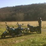
Well...??? More photos, please?!
-
This:
-
Me, too... if hitting that area, try & map a route there that goes more Southeast in Ohio and then link up with the Dry Fork Rd portion of WV-72 that drops you off near Harman WV & US33 where it gets real good. Look at the section adjacent to Canaan Valley where it twists in and out of the rippled folds of the side of the plateau/mountain for a good 10-15 miles. Very narrow very very twisty tight desolate road. Keep the speed down, it's a tricky one unless you know it well. 72 is pretty casual up to that point.
-
THIS ROAD IS SIMPLY AWESOME. Truly amazing. Great views, too. Pretty much anywhere in Pendleton County West Virginia is an amazing view, spilling over into Grant County next door. Germany Valley, Spruce Knob, Seneca Rocks, Nelson Rocks (wow, the guided climbing course...) Champe Rocks,Seneca Caverns, Smoke Hole Caverns, Stratosphere Balloon Cave, pretty much any roadside view, anywhere there, period.