

Chuck78
-
Posts
327 -
Joined
-
Last visited
-
Days Won
2
Content Type
Profiles
Forums
Gallery
Store
Events
Everything posted by Chuck78
-

93 repaving complete /road closure for 10 days mid August, 662, 541
Chuck78 replied to Chuck78's topic in Daily Ride
60 is now currently being repaved. It appears complete south of 541 @ Tunnel Hill, but north of 541 the northbound lane was not yet done but the southbound lane was near completion. 541 in Knox County is getting sections repaved an entire lane's width for sections of 75, 125, 250 feet long. Both directions. They started east a ways of the Licking County line and are moving towards Coshocton County, about 75% through Knox Co eastward. -
93 repaving complete /road closure for 10 days mid August, 662, 541
Chuck78 replied to Chuck78's topic in Daily Ride
93 was getting repaved on the south of Adamsville section towards Zanesville as of a few days ago as well, and is likely complete now. The bridge repair road closure is probably still in effect through this week on the section just south of 541. -
Can anyone recommend some curves close to the Mason/Maineville area?
Chuck78 replied to Giff74's topic in Daily Ride
Ahhh...here. 1st map Google didn't like my pin points and skipped Oxford Rd, but you can see it right near the top if the route: " http://goo.gl/maps/DCQYX Try this route instead, https://goo.gl/maps/O6HrK same thing but skips an ok section of Mudlick Rd that you can hit on your way out, in favor of right outta the gate hitting the tight low speed 90+ degree turns on Friend Rd and then some big long nice turns on Astoria Rd, then it dumps you into Oxford Rd which has some GREAT turns nearing the top of a good little hill climb, some of which are right in front of houses (be respectful of homeowners & watch out for cars pulling out of driveways) Then you go through farm fields for a few minutes to southbound mini roller coasters on the NW Brown's Run Rd (or Puddenbag Rd). Then Browns Run turns into Elk Creek Rd, you hang a left on 122 for a short jaunt to Michael Rd which has just enough curves & elevation changes to keep it interesting. Then after a quick connector on Trenton-Franklin Rd, you hang a left on a totally different road also named Brown's Run Rd for some very nice little river (stream) valley curves the whole way. A deer jumped out of the thick brush between the creek & the road once here on me, be careful. Then you hang a left on Hetzler Rd for a quick jog & continue forward where it splits off, onto Hinkle Rd to Rocky Rd, which transitions to chipseal somewhere (a bit bumpy but good curves to challenge you). There are also a few good curves on other adjacent roads, but this loop was the best continuous run I could find anywhere in the central & southern Dayton area all the way through Hamilton & the north end of Cincinatti. I rode all over that area in the evenings for one month and this was the most satisfying curves loop I could find. 122, Strebee Rd, W Alexandria Rd, Dickey Rd-to-NoMan's Rd, Thomas Rd, & Cloister Cliffs Dr to Sloebig Rd (southbound, or loop around the country club on Cloister to Sloebig to Thomas), those all have a handful of good curves as well if you care to study the map & ride the loop once & then explore a few side branches. Not much else in the way of twisties near there, but check out the terrain view map in your area to look for curvey roads near the hills." Another guy posted after to hit Ceasar's Creek (State Park) area & the area around Bellbrook. I am unfamiliar with the latter and have not been to Ceasar's Creek since the early 1980's as a kid... -
Can anyone recommend some curves close to the Mason/Maineville area?
Chuck78 replied to Giff74's topic in Daily Ride
From me on that topic 15 months ago: "Coming from the hotel in Franklin/Middletown, I'd hit a few really good turns on either Manchester Rd to Franklin, OH or go further north to West Lower Springboro Rd. The main route after that was in the areas NW of Middletown & W/S of Germantown. 123 out of franklin/carlslile to Sugar St to Mudlick Rd to OXFORD RD. Then left on either Brown's Run Rd (turns into Elk Creek Rd), or stay on oxford to puddenbag rd which turns into west Alexandria rd (look for great hill climb up Strebee Rd, then turn around & continue on route). If Puddenbag, hang a right on Elk Creek Rd. L on 122 Middletown-Eaton Rd From there do another mini loop of tighter & some chip seal roads: L on Michael Rd L on Trenton-Franklin Rd L on BROWN'S RUN RD(totally different than other nearby Brown's Run Rd, & Cloister Cliffs Dr & Myers Rd here have potential, I think I rode 1 once with big smiles up wooded hill climb) After that nice run, L on Astoria/Hetzler Rd, R on Hinkle Rd (twisty chipseal) - turns into Rocky Rd - which dumps you into Friend Rd where you can catch the NW Browns Run Rd again, or make a R on Friend Rd If you made the Right on Friend Rd, you can hang a L on Astoria Rd for a couple of great curves where it merges back into Mudlick Rd near beginning of loop, or you can take Friend Rd further down to to the Germantown-Middletown Pike - where on Friend you encounter a few hard sharp low speed tight 90 degree knee dragger turns & then some gentle scenic sweepers on the Pike northbound. Glancing at the Google terrain layer maps, this south-SW-of-Germantown area seems to me to be the best riding near Dayton." "Then 25 minutes later I looped it into a totally different & unconnected Elk Creek Rd that was quite twisty. That one was further south. Closer to Hamilton & Cincy, I didn't have any luck finding roads closer to that as far as twisties. I linked up to a dozen or more 12-20mph ultra tight turns in that route, often near houses though, but lots more 25-45mph fun turns. No mecca of any dort like southeast Ohio, but it was a good ride every time none the less." I thought I linked a Google map on there somewhere but did not see it. -
Can anyone recommend some curves close to the Mason/Maineville area?
Chuck78 replied to Giff74's topic in Daily Ride
-
Can anyone recommend some curves close to the Mason/Maineville area?
Chuck78 replied to Giff74's topic in Daily Ride
I recall Oxford Road being on the northwest corner/end of that loop and then my alternate road to cut south off or near that I think was the northern Browns Run Road, there was a second road that was slightly better that I would hit off Oxford southbound (I recall a Y veering left???), then on the southern/SW end I would head back North on the southern / different road by the same name Browns Run Road. That had a lot of curves and was down in a nice little creek valley. Them turned into a chip seal road briefly on the northern end of that (different road?). Elk Creek Rd if I recall correctly was one of the roads between Oxford and there. It was a good run coming from near the Super 8 motel off I75 on the edge of Middletown and cutting north of town into Franklin, then across the river at Franklin and towards Trenton-Franklin Rd or something. Southern Indiana has some very nice terrain and Hoosier National Forest, & Brown County has some great great mountain biking. I wonder how that area is and how far from you? The Suzuki GS forum does a Brown County Rally every year there. Hocking Hills and Zaleski State Forest are great riding also. 1.5 hrs from Cincy? Hocking on weekdays only during hiking/outdoor rec season though. -
Can anyone recommend some curves close to the Mason/Maineville area?
Chuck78 replied to Giff74's topic in Daily Ride
The only good roads I was able to find anywhere near you or near Trenton Franklin and Middletown in between Cincinnati and Dayton. I posted a map a year or two ago for someone else asking the same question. I was down there on two different occasions for three or four weeks at a time living in a hotel four nights a week and installing 40 furnaces and doing a huge high-rise boiler job. I stuffed my bike in the back of my work truck and was riding every single night. Basically only one main loop that I found was excellent, basically all centered around little River Valleys. Or Creeks rather. The only name I can remember is Browns Run Road or something to that effect, and I believe they were two of the same name within 5 miles of each other, the southern one had nice curves. I definitely posted a Google map link of the route and an alternate. It was actually quite good for that area. I discovered all of these roads basically by using Google Maps terrain layer, and zooming in anywhere I saw nice elevation changes, especially around streams creeks and rivers. There are big Hills around Cincinnati, but I really couldn't find much in the way of twisty roads down there. The hills were too long and gradual, not tight and unpredictable like little valleys carved by streams or like Appalachian Southeast Ohio. AND Kentucky! Very good riding there. Especially the Red River Gorge area & Daniel Boone National Forest. There is also some really awesome riding down on the Ohio River near Gallipolis Ohio. Really great riding actually. Not much else down that way besides the river and the hills -
Ohio State Route 93 will have repaving completed this afternoon between 208/Adamsville & 541/93 - but they were doing 10 days of (bridge?)work near 541 so dont try to run 93 more than 5 mi north of 83/93 intersection/merger before Aug 19th or 20th completion. From just outside of Zanesville to Adamsville, they have repaved several 2' wide 40' to 100' long sections of the outside edges of the lanes. Not sure if they will be repaving any of this in it's entirety. It also looks like the very fun 1 mile or so of 208 just north of the right turn on 93 @ 208 is getting repaved. I don't normally take 208 so I can't comment on how far that is getting paved. I also believe 662 that runs between 209 & 83 has/had (10 days ago saw signs) a road closure. I'm not sure if a bridge out or what is going on. That road looks real fun, will need new pavement in the next few years but looks good from either end currently - just lots of cracks in pavement but still smooth. I also just saw a 541 detour sign in West Lafayette, but not sure of that is still around from the bridge out on 541 just west of 93&541. That bridge FINALLY just reopened.
-
Very good to know! I will definitely be checking that out! I just got a '99 KDX220 2 stroke trail bike and a bunch of parts I the mail to hop it up and do some needed maintenance, but our Sunday Dorr Run/Long Ridge Wayne National Forest ride might be pretty soggy... I think I will take a buddy instead on a road ride if the "thunderstorms in thr vicinity" weekend firecast does not change. I was either going to show him 685/78 etc or 93&83 east of Zanesville. 93 will have repaving completed this afternoon between 208/Adamsville & 541/93 - but they were doing 10 days of bridge work near 541 so dont try to run 93 more than 5 mi north of 83/93 intersection/merger before Aug 19th or 20th completion. Will post another topic on this.
-
Yes that is a truly epic section there. I am surprised if you have never been on that section before! Be sure to stop at the old barn just west of 555 on the north side of the road by the abandoned looking white aluminum siding 1 story house. That view is comparable to many places on the Blue Ridge Parkway honestly (not as much the areas around Asheville NC however, but BREATHTAKING and unbelievable that the view in front of you is in Ohio). Most of 78 is obscured by trees but the further east you get on that section, the more quick little peeps you can get through the trees until you have a couple of very great scenic panorama views nearing 555. We love to take 377 south of there to 555 and 676 and that great little stretch of 550. or 78 to the river and north to 669 west. Great stretch on 669. 555 north of 78 is good for 555, and takes you directly to the best stretch of 669 east to the river, but 669 is pretty decent for a little ways west of 555 as well.
-
Similarly, 260 lost the entire southbound lane down into the creek 25 feet below for about 65 feet road length somewhere about 1/3 of the way down from 78 towards 26. There was a one lane traffic light alternating northbound and southbound traffic when we hit it Sunday. I can only assume they will have to shut the road down to fix it. There was also a bridge out or something on Frostyville Rd nearby there, I forget the state route name, but it parallels 260 just to the west. I was wanting to give that one a try for once (usually hit 250), but no go on the detour signs and google maps not letting me even plot a route down there (always a sign that there is a construction/bridge road closure detour). Not so related to Denny's topic - other areas: 669 just east of 668 there must be a detour, google wouldn't let me plot a route across the creek there. 541 near Eighth Street Rd there is also a bridge out.
-
Hoping to hit Proctor Creek Rd one of these weekends in the near future. Keep us posted on construction if any of the rest of you hear of conditions.
-
Very very nice area, quite far from Columbus however so I have only been there once, regretfully. There are some top notch county roads down there if they are in good enough shape still.
-
Oh and by the way the pavement on 266 is still TERRIBLE if you are looking for a route to cross east over the Muskie River from 377. A year later, and only one patched section where last year you would have needed a kidney belt to keep your innards in place,
-
We rode it to bypass a crazy severe thunderstorm on the Muskingum River area on last Sunday. 377 to 78 to 555 to 37 and home to Columbus. My first ride on 555 in 5 or so years left me with the first impression of "wow this pavement is total garbage!" That ended quickly as we got slightly northbound of 78, and then I was left thinking "wow, maybe I need to give this road another chance." I love tight tight roads, but the section south of 78 toward 377 or 676 was just no fun for me back then 5 years ago, not very flowing, dirty, nothing banked at all, not really a good riding road. People that call it the Ohio Dragon (same with 536 being called that) have probably either never been to US129, never ridden the best roads SE Ohio has to offer, or just are full of too much Ohio Pride and haven't ridden enough of the real good stuff. I'd rather ride the least tight road attraction in the area, 377... smooth flowing higher speed turns, a pleasure. This is coming from a guy who seeks out the tightest of the tight to throw heavily modified vintage 1970's-early 80's japanese bikes into...
-
Nice. You just inspired me to look up how long it takes to use I-70 to Moundsville-Hundred section of US250 to get to my favorite spot down that way.... Not much longer at all vs 33 all the way there with sections of 33 bypassed by US50 and I-79... Now if we trailer the dirt bikes down and street bikes, we'll probably stick to US33 the whole way https://www.google.com/maps/dir/Bryden+Road,+Columbus,+OH/Moundsville,+WV/Hundred,+WV/Grafton,+WV/Cool+Springs+Park,+George+Washington+Highway,+Rowlesburg,+WV/Hendricks,+WV/Harman,+WV/Seneca+Shadows+Campground,+West+Virginia+28,+Seneca+Rocks,+WV/@38.9413894,-79.9207093,10z/data=!4m26!4m25!1m2!1m1!1s0x883888f7ce1c2827:0xcddbdb16d07e7eba!1m2!1m1!1s0x8835e0beb0413939:0x81a89159bd7ba04e!1m2!1m1!1s0x8835f34c8df122c3:0x47ff0857484dcfbc!1m2!1m1!1s0x884a89228f0f070b:0x178335413d3f270d!1m2!1m1!1s0x884abd0a88b22989:0x9ebfb7b66efa3a93!1m2!1m1!1s0x884ac467d3cff22f:0xee284af809398ecf!1m2!1m1!1s0x884ad72563f1dcb9:0x6ee342dd833c3883!1m2!1m1!1s0x884b2ab6bd8186e7:0xc7e85b2d28068c74!3e0 I'm basically free from here on out, wife is always on the road for her job during the riding season, and I finally got my rehab project giant old historic mansion (nightmare the ex left me with 8 years ago) sold. I keep telling my buddies, THREE MONTHS OF RIDING WEATHER TO GO, LETS RIDE WV!
-
This is one of the few events that I won't miss it for anything every year. Definitely one of the biggest highlights of the summer. Suzuki is sponsoring the event, and also bringing some historical vintage team Suzuki race bikes in order to commemorate the 40th anniversary of super bike racing. Wes Cooley the famous Superbike star from the 1970s who rode for Suzuki / Yoshimura is also the Grand Marshal of the event. Camping out at the event makes it about triple as epic even! The AMA VMD campground scene is probably the most rowdy things ever get at Mid Ohio... I'll be putzing around on a black/gold modded 1977 Suzuki GS 750 with fox piggyback shocks with red reservoirs, or maybe finally getting the rat rod bike hauler 1962 GMC Panel Truck ( delivery /work truck version of the Suburban) on the road last minute tomorrow. My buddy has a beat up looking green 78 GS750 that we are finally getting mechanically restored (& a 'zuk dr350 dual sport). I'll be in the back corner if the 1st campground field hopefully. Hopefully with the old truck. Skinny guy 5'10" scraggly brown hair sideburns, my buddy looks similar in description but shorter hair graying & green gs750. Say hello if ya can manage to spot me. Chuck's the name. Wife's riding the go kart in the wall of death motordrome show so I'll be around there a lot.
-
Road recommendations near Asheville / Maggie Valley NC?
Chuck78 replied to Chuck78's topic in Daily Ride
Haha That's my wife! Did you see a ratty flat black 77 GS550B behind the wall of death motordrome? Luggage rack & old shoei batwing FM2 fairing? Her bike... I was just down there a few days ago. If today wasn't the last day of their shows, I'd be heading back for this weekend with my truck to get a 351 Magnum big block V6 1966 gmc truck engine down that way... long haul. Hope the weather is better for your return trip than mine. Only 240mi in 55 degree rain this time! -
Road recommendations near Asheville / Maggie Valley NC?
Chuck78 replied to Chuck78's topic in Daily Ride
High Knob Lookout off of VA(?)-619, nicely flattened mountainscape thanks to smartphone wide angle lense cameras! -
Road recommendations near Asheville / Maggie Valley NC?
Chuck78 replied to Chuck78's topic in Daily Ride
US441 through the Great Smoky Mountains National Park was probably my least favorite motorcycle ride of all the destination areas I hit. It was nice, but generally lower speed limit than the 45mph BRP even, mostly 35mph & a lot of 25mph zones. More traffic by far..some nice sights, more up close views of cool mountains in the very near distance, slightly different scenery than similar views on the BRP. The best mountain view(s) of the whole trip were definitely from the BRP near the mid 450-something mile range just south of US19/Maggie Valley exit, the 1st real overlook looking back over the edge of Pisgah(?) and over the Cherokee Reservation land and then into the Smokies toward Clingman's Dome (highest peak in the park). Very impressively stacked cascading mountain ridges one after another piled up to the sky. I wish I took a photo of this. I didn't have much time for photos, and was very suited up with cold weather gloves and all. I have also gotten very jaded on cell phone pictures, after realizing that the reason things don't look as impressive and cell phone pictures is because all cell phones have wide-angle lenses that flatten out the hills and straighten out the curves. I keep thinking there has to be some app or filter that will un-wide-angle lens the pictures so they look more like what we see with our naked eyes, i.e. far more spectacular & impressive. Unfortunately I did not make it down to the number one most widely recommended road amongst all people I consulted on for roads advise, the Moonshiner 28, or rather the Hellbender 28 section. Did not make it to Wayah either. Next time. I realized one big difference in this area vs the NE WV Ridge & Valley Province if mountains in the Monongahela & over the VA border into George Washington Jefferson National Forest. There are many more easily accessible epic waterfalls in the Smokies/Pisgah/Nantahala/Black Mountains/Craggy Mountains regions just southwest of the end of the Ridge & Valley mountain topography. More randomly staggered mountains vs 30+ mile long ridges with valleys in between. Makes for better waterfalls and probably a slightly higher concentration of very twisty roads. WV is still very high up on a pedestal for me due to proximity & terrain however. The Harman VA to Hinton WV section of US33 at the easternmost WV/VA border crossing is still my top favorite section of road anywhere. Soooo flowing, nicely banked curves on the WV side of the mountain, great views, big elevation changes... the proximity to Reddish Knob/Reddish Knob Rd & US250 over the same mountain, Smoke Hole, & the ride to the top of Spruce Knob... and WV-72 for the incredibly remote & tight stretch... my heart definitely feels very at home in NE WV still. Too bad the Asheville area is so far away otherwise it'd be the same for me, a home away from home. I skipped 197 & another route further north through Pisgah, & opted not to go out of the way to continue on US 421 to the 421 "The Snake" section as it was out if the way for us, but these areas more north of Asheville also deserve some good recognition. I was quite impressed with video footage of riders on 421 The Snake... -
Road recommendations near Asheville / Maggie Valley NC?
Chuck78 replied to Chuck78's topic in Daily Ride
One of my favorite loops ever was right here @ 215&BRP. 215N to 276S to BRP southwest.... very very awesome. Venture off the triangle loop down 276 a bit further to Looking Glass Falls and maybe do the hike to Looking Glass Rock - a massive granite dome that sticks up above all the lower mountain terrain and can be viewed for many miles off the BRP between NC215&US276 NC215 & US276 were right up there with the most ultimate of lower to medium speed mountain twisties. Both had odd pavement, "very grippy" as a review I read stayed. In excellent shape as far as almost no cracks/potholes, but a somewhat rough texture that looks similar to a tar and chip road after the gravel has been bedded in, but it was asphalt. Very grippy is right. I noticed a little extra wear on my tires after that, the rubber was a little more coarse looking, but I wore it all down further from the additional riding we did and it's all smooth again. If I'm not mixing the two up, 215 was more 20-40mph turns and VERY FUN and flowing. Some tighter. LOTS of elevation change! US276 was the tighter of the 2, many 15-35mph curves, with far more 15-20mph curves than 215. Both are a MUST RIDE, loop both directions, really. BRP is pretty standard fare there for the area. Moderately fun endless amounts of back to back sweepers, AMAZING VIEWS... when 70 degrees in the valleys, the BRP temperatures fluctuated A LOT depending on elevation and which side of the ridge you were on. Many places that afternoon it was low 60's & sunny, then the BRP crosses to the other side of the mountain ridge, & would be all shaded and very chilly (50 degrees or so). Bundle up in layers in mild weather! Further NE on the BRP you intersect Buck Creek Rd Rt 80, very twisty portions of this around the Parkway for sure. You can loop this down to (Johnson Creek Rd??? I forgot! to a fairly straight US or state route North) then to 226 & left onto 226a around the Little Switzerland area, which was pretty darn awesome on 226a. Then loop back onto the BRP at Little Switzerland, back to Buck Creek Rd Rt 80 I can't wait to go back to this area when I have more time. This trip was too rushed, rainy, & cool. My buddies at my favorite vintage Japanese motorcycle shop basically all unanimously said "take me with you next time you ride to Asheville!" -
Road recommendations near Asheville / Maggie Valley NC?
Chuck78 replied to Chuck78's topic in Daily Ride
Monday we ventured out quite a lot and rode the Blue Ridge Parkway from us19 southwest of Maggie Valley NE toward other sections of Pisgah near Asheville NC. from the US19 intersection of BRP NE to the 6500ft highest point of the roadway on BRP was quite possibly the best mountain scenery views I've seen, particularly just beyond 19 at the first good overlook and the following curve after that. Stacked layer upon layer of mountains in the distance... beautiful. We road the Parkway quite a ways to 215. Only a half a dozen curves were a max sporty speed of 45mph, the rest were mellow sweepers but basically ENDLESS amounts of good sweepers. It'd be a lot of fun at 55mph, but 45 allows decent fun in the curves and some time to catch the amazing views... after all, this road was basically built around amazing views Another break in the rain, to be continued -
Road recommendations near Asheville / Maggie Valley NC?
Chuck78 replied to Chuck78's topic in Daily Ride
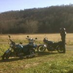
Alright....finally (maybe)...I might have used a photo posting format that was agreeable with this forum! -
Road recommendations near Asheville / Maggie Valley NC?
Chuck78 replied to Chuck78's topic in Daily Ride
Alright....finally (maybe)...I might have used a photo posting format that was agreeable with this forum! -
Road recommendations near Asheville / Maggie Valley NC?
Chuck78 replied to Chuck78's topic in Daily Ride
(Photo that was supposed to be in last post)- 51 replies
-
- 1
-

-
- carolina mountain
- twisties
- (and 3 more)