Chuck78
-
Posts
327 -
Joined
-
Last visited
-
Days Won
2
Content Type
Profiles
Forums
Gallery
Store
Events
Everything posted by Chuck78
-
Here ya go. Google Terrain layer map view is the best. this is Shenandoah mountain on the West Virginia and Virginia border, the border is directly on the ridge at the top. It is nearly a 2,000 foot climb and descent up and down this mountain. Just to the north of the road crossing up the ridge is a knob with an elevation of around around 4000-something feet. reddish knob to the south a little ways is much higher, 4400 feet or something. FlagpOle Knob and Bother Knob are nearest Reddish. High Knob is right in the vicinity above Skidmore Lake on the VA side partway down the mountain.
-
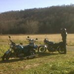
Original poster, more photos, please!? I am in love with that area.
-
Photo stolen from a Google image search, North Fork mountain, North a ways from the crossing of US33 near Seneca Rocks. More of north fork Mtn a bit closer to Seneca Rocks, taken from a very rugged hiking trail last September. Every time I climbed up to the ridge to catch a view from nearly any point on this incredible remote and rugged hiking trail, it looked perfectly picturesque just like this with rays of sunshine beaming down
-
Spruce Knob near 33& Seneca Rocks
-
WV/VA border overlook on US33
-
if you saw some pictures, you would question how wide the road is, three lanes total? the uphill sections have passing lanes so that slow vehicles can get over & us motorcyclists can enjoy it! This is no way affects how great the curves are thankfully.
-
Yes!!! basically just outside of Harman West Virginia after a nice long forested gradual uphill climb for miles, as soon as you see a sign saying entering Pendleton County, you immediately go around the next curve and your jaw drops from the incredible mountain views as you descend down rapidly the other side as you are rapidly dropping some serious elevation with a couple of very amazing horseshoe curves. The "trucks MUST use pull off lane to check brakes" sign tips you off a bit at the awesomeness. After that, you get to Seneca Rocks and then cut through Judy Gap and up another mountain with a lot more curves and steep grade than that first climb. Very fun up & down. Then as he said, long valley with lots of hills and lesser elevation changes, good easy curves. Then...wow. Shenandoah mountain climb to the VA border, and then descent down the other side. The holy grail of eastern United States mountain passes and twisties. Pictures don't do it justice, the grade of the road and the awesome banked turns are just incredible in person. The first time we rode this, we were so giddy we had to turn around and do it again, as it seemed as if it was built as a motorcycle playground or race track! Nonstop awesome curves and amazing views! after that there is a very long with Valley through Shenandoah National Forest and into Harrisonburg. Skyline Drive is quite a ways from there much further east, and is almost a sole mountain range standing on its own. 250 over basically the same Ridge as the absolute most amazing part of 33 is almost equal to that part of 33. the border between the Virginia's jumps West quite a bit down there, so it is entirely in Virginia, where Shenandoah mountain is split at the ridge between the two states.
-

new pavement amish rt258 freeport & rt78 and some other
Chuck78 replied to marlboro man's topic in Daily Ride
Ahhhh fracking and rough winters... Weren't 565 and 537 both repaved just 3 years or so ago? That's a bummer, those are two of my favorite stretches in that area. -
Darnit the same stretch that was reported closed several weeks ago, my favorite darn stretch of the entire road!!! I wonder if it was closed due to flooding? There are 3 bridges on that stretch, so any of them could be out from flood damage, or since the whole stretch follows a creek that tees into a much larger creek, it could be suffering from chronic flooding due to this insane monsoon summer.
-
That stretch does look quite impressive from a Google Terrain view map! 148 & 149 nearby there look to have some great stretches as well. 149 directly adjacent, Neff to Glencoe. Although 147 south of there chases up and down endless hills and ridges, where the twister of 149 follows a stream or river. I don't make it out east of Zanesville or Coshocton much, but 147 has caught my eye many times while browsing map routes on terrain view. Eight Street Rd north of 541 to Guernsey Valley Rd is quite a blast, but I haven't checked much else out in that area. A few roads just west of Cambridge also really looked like must-rides...6## something and 208 to 83 I think were two of them. One might have been called Hopewell something or other.
-
I was hoping for a fall colors ride on 78 between 13&555, so hopefully it will be up & running with a fresh resurfacing by then!
-
According to the ATH.pdf 2015 ODOT construction season bulletin that I downloaded from the ODOT website for District 10, the Athens County portion of OH-78 was awarded a contract in February. On the MOR.pdf for Morgan County, that stretch of 78 has a different project # & wasn't awarded a contract until 3 weeks or so ago, June 29th 2015, so we may be waiting a short bit for most of the rest of the Rim of the World section to get paved.
-
So is there more of 78 that is ground up for repaving, or just in need of repaving? I'm mostly concerned with only Glouster (78@oh-13) to oh-555, the "Rim of the World" scenic twisty ridge top Vista stretch.
-
I know...that stretch is definitely near the top of my top 10 favorite short stretches of road in all of SE OH. The incredibly long curves around the cliffs (mostly obscured by vegetation) just west of Ash Cave are some of the most fun in the region. & another stretch the same distance from the gas station... & the tricky Chapel Ridge. Goose Creek Rd is opposite that, need to try that one out again. Only time I tested it years ago, it had gravel & dogs in the road so I turned around halfway.
-
Good&bad, I was hoping to ride 78 this weekend before or after they paved it! Does anyone know the current status this week of 78? Last mention was July 9th. May plan for 3 wknds from now. Anyone know? Also, apologies for my typos in last month's post. Mary basically reiterated it in other words, 278 (NOT 78 as I said) was fresh pavement from Nelsonville down into Lake Hope EXCEPT for the awesome densely forested huge hill climb southwest bound just outside of Nelsonville. That section had several rough patches, although none of them encompassed the entire width of the lane, so some strategic maneuvering & it's still very fun. Unfortunately they ended the new pavement on 56 at 374, the best best stretch of 56 from 374 to South Bloomingville was still in decent shape though, as long as nothing too bad happened to it during the likely flooding
-
Wow you weren't kidding! I stumbled upon it accidentally (off of 541 to Guernsey Valley Rd & Johnson Hill Rd) & immediately recognized the name from this forum. Short & VERY SWEET! Very much like OH-685 out of Nelsonville (couple miles of AWESOME rollercoaster & curves climbing & descending a ridge) only a bit longer and slightly narrower. I noticed a bit of loose gravel in a few places on the first few extremely steep long hillclimb turns, but the rest was pretty darn clean. How is the stretch from Cambridge to Kimbolton? Looks pretty promising but not quite as rugged of terrain that it traverses. Actually, how are the rest of the county roads south of Newcomerstown? On the map, there looks to be a lot of amazing twisties through some densely packed rugged hills. I figured they were probably just like most of the rest of the area around Coshocton where if it isn't a state route, then it is 85-90% likely to be gravel. Although Guernsey Valley Rd and Johnson Hill Rd were both nice looking & paved, so maybe there are more paved in that area south of Newcomerstown & mostly west of Johnson Hill Rd (what 8th St Rd turns into)????
-
Looks like 78, the southern part of 555, & Washington CR 11 are the only ones slated to be repaved in that area deep down in SEOH, according to the ODOT Marietta District webpage.too bad for 536, seems that it hasn't ever had good pavement since I started venturing out deep into SEOH (5 years). Let's hope 255 & 26 stay good enough for another year or two.
-
I checked a link someone posted from odot for other SEOH areas and went yo the Athens/Marietta district. Looks like 4?56 in Hocking & Vinton counties gets repaved all the way from 374 & east, but 78 only from Nelsonville (including the hill climb stretch which they are probably putting off due to difficult terrain) but only from Nelson ville south to 56. I thought it was repaved south of 56, but I jumped off on Two Mile Rd within 100 yards of 56, so I could be mistaken. So new pavement on 56 extends southeast from 278 just to the Athens County Line, not all the way to 691.
-
Two Mile Rd just SW of 56 off of 278 was a very nice back way around Lake Hope, BTW. 278 south of 56 is more higher speed sweepers than the northern half, but very lush dense forests & very few driveways & other potential hazards. Two mile has slightly tighter curves but more residences. Good alternate or road to loop back on (so is the southern half of 328).
-
278 out of Nelsonville southwest bound is brand new pavement from the top of the first & biggest hillclimb & well beyond 56. The hill climb section had a few rough patches to avoid but still very rideable with caution. 56 was ground up for repaving east of 278 to who knows how far east, & stopped immediately after 374 on the west end of the road work. The pavement from 374 to 664 is still in fine shape. That is one of my favorite stretches of scenic twisty road in all of Ohio. I hope they get the hill on 278 also, but I can see it presenting difficulties due to it's very long very steep grade and lower medium speed banked turns. Great southbound route, I love twisty hill climbs.
-
60 from 16 north to Warsaw has no closures & is in pretty great shape. My new job has me driving up there several times a month, & I have been amazed at how nice of a riding road that is. I wasn't that impressed looking at it on the maps compared to Southeast Ohio, but in person, it was quite nice. No idea on the good stretch of 62 at present
-
Crap that terrain view link now only displays the terrain layer on desktop/laptop browsers, not on mobile devices. If you compare the route & the terrain layer, you will see the Oxford Rd & Brown's Run to Hinkle Rd routes are on the most hilly terrain on the entire map, & also are the most curvey fun roads. Good correlation to watch out for when searching for fun roads in your area. Also sometimes along rivers or creeks you will find twisty roads (& usually steep hills adjacent to them).
-
Since Google keeps downgrading their once-amazing mapping service, I can now only show you the terrain view with no driving directions/routes on the map, but here it is: https://www.google.com/maps/@39.571876,-84.4085472,13z/data=!5m1!1e4 OR https://goo.gl/maps/cYiHu
-
Try this route instead, https://goo.gl/maps/O6HrK same thing but skips an ok section of Mudlick Rd that you can hit on your way out, in favor of right outta the gate hitting the tight low speed 90+ degree turns on Friend Rd and then some big long nice turns on Astoria Rd, then it dumps you into Oxford Rd which has some GREAT turns nearing the top of a good little hill climb, some of which are right in front of houses (be respectful of homeowners & watch out for cars pulling out of driveways) Then you go through farm fields for a few minutes to southbound mini roller coasters on the NW Brown's Run Rd (or Puddenbag Rd). Then Browns Run turns into Elk Creek Rd, you hang a left on 122 for a short jaunt to Michael Rd which has just enough curves & elevation changes to keep it interesting. Then after a quick connector on Trenton-Franklin Rd, you hang a left on a totally different road also named Brown's Run Rd for some very nice little river (stream) valley curves the whole way. A deer jumped out of the thick brush between the creek & the road once here on me, be careful. Then you hang a left on Hetzler Rd for a quick jog & continue forward where it splits off, onto Hinkle Rd to Rocky Rd, which transitions to chipseal somewhere (a bit bumpy but good curves to challenge you). There are also a few good curves on other adjacent roads, but this loop was the best continuous run I could find anywhere in the central & southern Dayton area all the way through Hamilton & the north end of Cincinatti. I rode all over that area in the evenings for one month and this was the most satisfying curves loop I could find. 122, Strebee Rd, W Alexandria Rd, Dickey Rd-to-NoMan's Rd, Thomas Rd, & Cloister Cliffs Dr to Sloebig Rd (southbound, or loop around the country club on Cloister to Sloebig to Thomas), those all have a handful of good curves as well if you care to study the map & ride the loop once & then explore a few side branches. Not much else in the way of twisties near there, but check out the terrain view map in your area to look for curvey roads near the hills.
-
Wow, this is great news! I rode it in 2013 & 2014 many times, & it was in completely acceptable shape, but after 2 very harsh winters in a row, I can see how it could have deteriorated. Thanks so much for the great news update Denny. Are there lots of deteriorated pavement spots in turns currently? Potholes? What is the status of many of the great roads east of I-77 (Caldwell/Marietta) & south of Woodsfield or I-70? Like 26, 255, 260, 536,556, 537, 565, etc? A lot of fracking has been going on down there and I have heard mentions of it really taking it's toll on the tarmac.