
Leaderboard


Popular Content
Showing content with the highest reputation on 06/08/2016 in Posts
-
Oh, fuckin funny harr harr.2 points
-
... and instead classify "cellphone use" as "impairment" under OMVI.1 point
-
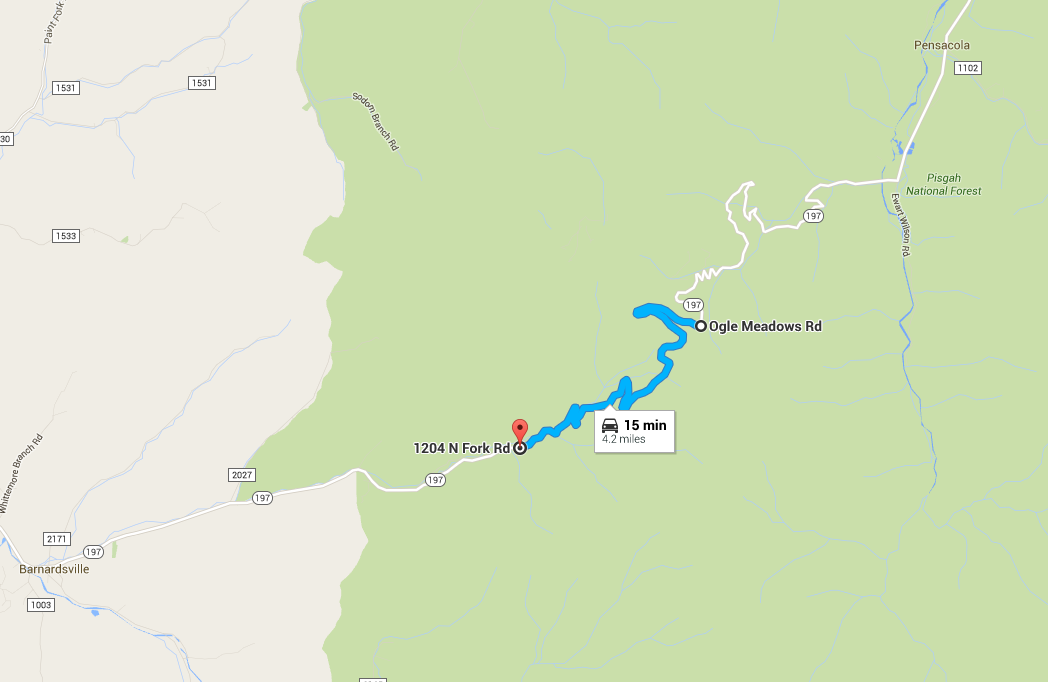
I think we are talking different rt. 197's. This is the route we took. If you google map "Pensacola NC." This will pop up and you can zoom in. When you do you will see the photo box to the left of the switch backs click it and it shows the gravel road. Like bubba said you can street view it as well. We road yours today. Nice road. Have a safe trip.1 point
-
Unpaved section is at the very top of the road as it crests the mountain. About 4 miles of gravel, but pretty smooth and graded last time I was down there. Not a problem even on a sport bike as long as you take it easy. Use Googlemap Streetview function to see the exact section where the gravel starts/ends.
 1 point
 -
You're just mad the thigh high boots didn't fit. I know... I am going back to the kitchen now to make your sammich...1 point
-
My laptop is slower with 10, I hate all the little apps and bullshit it adds.1 point
-
Hey big brother... Glad you finally said hi. You can pick up your sammich next week. Yes it is true he is my brother.1 point
-
1 point
-
There are some great lease incentives going right now.1 point
-
INDIAN DEMOS ALL THIS WEEKEND AT IRON PONY IN COLUMBUS. just sayin....+1 point
-
I was just there for gas. Minerva wells now for food then down 14 1191 point
-
This trip snuck up on me... still haven't unpacked from my last work trip. Picking up a new battery now :-/1 point
-
Is it bear proof? You gonna skeered....1 point
-
I can accept that.1 point
-
1 point
-
Hookers and Blow.1 point
-
I'm mostly ready I think. Just final things to pack in the morning like toothbrush, deodorant, chargers, etc.1 point
-
Please join me at Quaker Steak and Lube bike night June 8th for the kick off of bike nights! I am receiving the Saved By The Helmet Award from motorcycle Ohio at 7 o'clock. It would be great for me to meet as many of you as possible, especially those of you that donated enough money for me to continue therapy needed for me to get out of a wheelchair!! This is big for me and I am so nervous and excited at the same time1 point
-
I may have these! Kawasaki parts that are new in bags. Lemme see...1 point
-
RIP Luis Salom1 point
-
Eh, I'm thinking about trailering.1 point


This leaderboard is set to New York/GMT-05:00